Hello Willow, the tripawd Labrador, here again. My hu-man and hu-mam are both resting after a brilliant walk, so I thought I’d tell you all about it. This is a very historic route as it was used by drovers and the military in the past, and the rock formations we’ll see are even older, but more of that later.
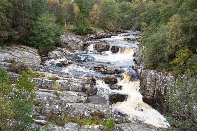
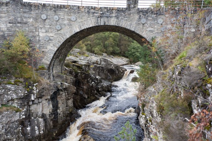
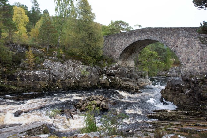
We parked at a place called Silverbridge, which is past Garve on the Ullapool road. It’s another Forest Enterprise carpark and is nice and safely away from the main road which is great for a dog like me. Well, once we left the car park we crossed a lovely old bridge and I was going to explore one side of it but was told there was a nicer place to visit. So down some steps we went and then I saw the bridge properly. It’s a really old bridge, my hu-dad thinks it was built around 1762. Perhaps my humans remember it being built when they were young? There are nice waterfalls here and the water looks lovely as it drops over them.
We followed a well laid out path along the river – it was up and down a bit to start with but my hu-mam made it no problem and then it flattened out well. We crossed a little stream, and somebody had very kindly thought of my humans and put in a crossing. Now, as you probably know, my natural temptation is to jump into every bit of water I can find but I was good on this trip.
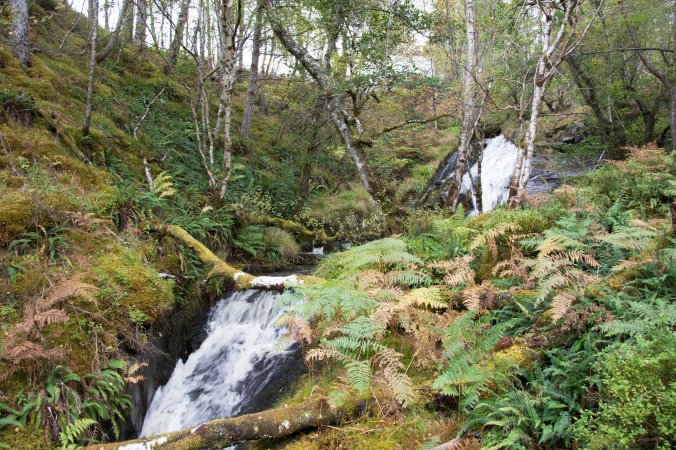
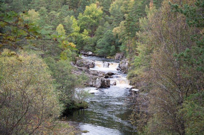
As we walked, the river was beside us and every now and again we saw some lovely views of the river. Now, my hu-mam takes photos of our walks but what no-one really knows is that I stop, find a nice spot with a good view, and then she comes along and takes the photo. She’d never manage without me, you know. On the other side of the path was mixed woodland. It was really peaceful and, as it was autumn, the leaves were all changing colour.
We then came to a fork in the path, which was greeted with lots of “oh, we’re here already” from my hu-mam. So, I took my humans across a really steep bridge and into another carpark. This one was hidden between the trees and you could see the river really well. It was at a place called Little Garve which was a really important stopping place for drovers and their cattle, as they used to rest here, and get shoes put onto the cattle.
The Drove Roads
Many years ago people called Drovers used to walk cattle from the north and west of Scotland down to markets in the more populated areas of Scotland. In this part of the Highlands these markets could have been in Muir of Ord which used to hold a big fair. Very often these cattle would then be walked down to the central belt of Scotland to large trysts in Falkirk or Crieff. For the drovers who were using the drove roads in this part of the Highlands they would have been walking on paths, but from Little Garve onwards they would have been walking on much harder roads so needed to shoe their cattle to make it easier for them to walk on the hard roads.
Little Garve Bridge
Now, the bridge we crossed is really interesting. Again, it’s a really old bridge as it was built around 1762. After the Jacobite uprisings a man called General Wade built lots of roads and bridges across Scotland. This was to make it easier for the troops to move around the country to stop any further uprisings. It’s thought that this bridge was built by Major Caulfield, Wades successor.
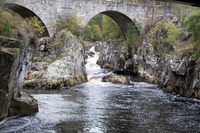
We then followed the river back to Silverbridge. Now, you may not know this about my hu-mam but she loves rocks, see she does have some good taste. So, we were both in our element on the way back as there were fantastic rocks in the river.
A Bit about the Geology
The one main feature in this whole area is Ben Wyvis a mountain which is 1046 meters high. This whole area has a Psammite bedrock and had originally started off as a sandstone but underwent metamorphism. This was about 541 to 2500 million years ago. What’s really interesting about this walk is that the area around Little Garve has superficial deposits that were laid down about 2 million years ago in a fullivial, or river, setting. This is different from the superficial deposits nearer Silverbridge as they are glacial deposits from about 3 million years ago.
You may be wondering how a dog knows so much about geology. Well, on the way back I was encouraged to cool my paws down in a burn. But then I found a much better pool which I waded into, cooled my paws down and had a big drink. You know, you can learn an awful lot from licking rocks. Actually, I think I gave my hu-mam a bit of a fright as she thought I’d jumped into the river. Ha ha, fooled you.
So, all too soon we came back to Silverbridge, so it was quite nice to get a different view of the same bridge.
Grid Ref: NH 395 630
Length, about 2-3 miles and took us about 75 to 90 minutes
References:
https://canmore.org.uk/site/12271/little-garve-bridge
http://www.geograph.org.uk/photo/3470804
http://www.ambaile.org.uk/detail/en/32503/1/EN32503-little-garve-bridge.htm
http://www.snh.org.uk/pdfs/publications/nnr/The_Story_of_Ben_Wyvis_National_Nature_Reserve.pdf
